

 Image 1 of 3
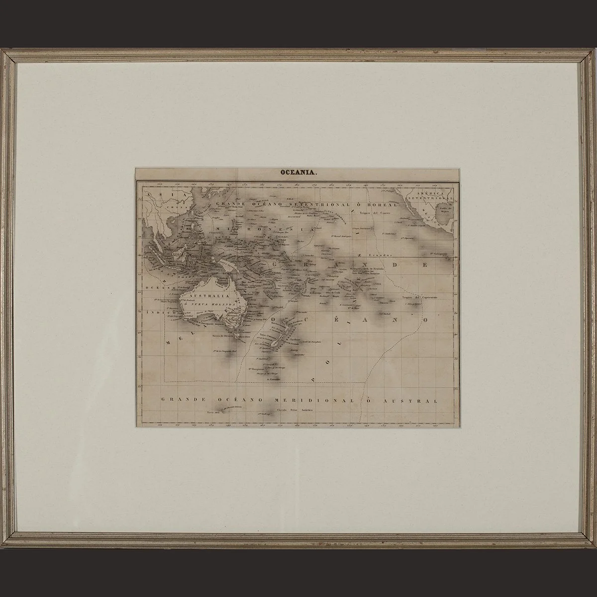 Image 2 of 3
 Image 3 of 3
Europe
Engraving on paper, hand colored
Height 15 3/4" (40 cm) x Width 18 1/2" (47 cm) including frame
Provenance: Joyal Arnold, Honolulu, HI
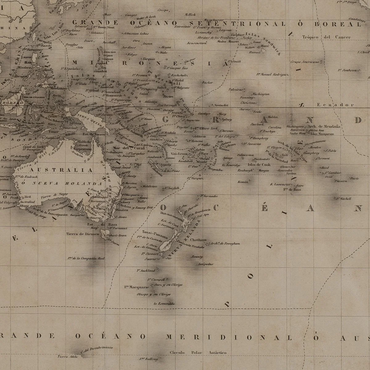
This engraved and hand-colored map of the Pacific and Oceania dates to the 1840s, a period of intensive European cartographic activity in the region driven by ongoing naval exploration, missionary activity, and commercial interest in the islands. The map covers a broad geographic area including island groups across Polynesia, Melanesia, and Micronesia, with place names and coastal outlines reflecting the state of European geographic knowledge in the mid-19th century. It comes from a private collection in Honolulu and is presented in its period frame.
We ship free anywhere in the world, fully insured, packed by hand.
Europe
Engraving on paper, hand colored
Height 15 3/4" (40 cm) x Width 18 1/2" (47 cm) including frame
Provenance: Joyal Arnold, Honolulu, HI
This engraved and hand-colored map of the Pacific and Oceania dates to the 1840s, a period of intensive European cartographic activity in the region driven by ongoing naval exploration, missionary activity, and commercial interest in the islands. The map covers a broad geographic area including island groups across Polynesia, Melanesia, and Micronesia, with place names and coastal outlines reflecting the state of European geographic knowledge in the mid-19th century. It comes from a private collection in Honolulu and is presented in its period frame.
We ship free anywhere in the world, fully insured, packed by hand.