

 Image 1 of 3
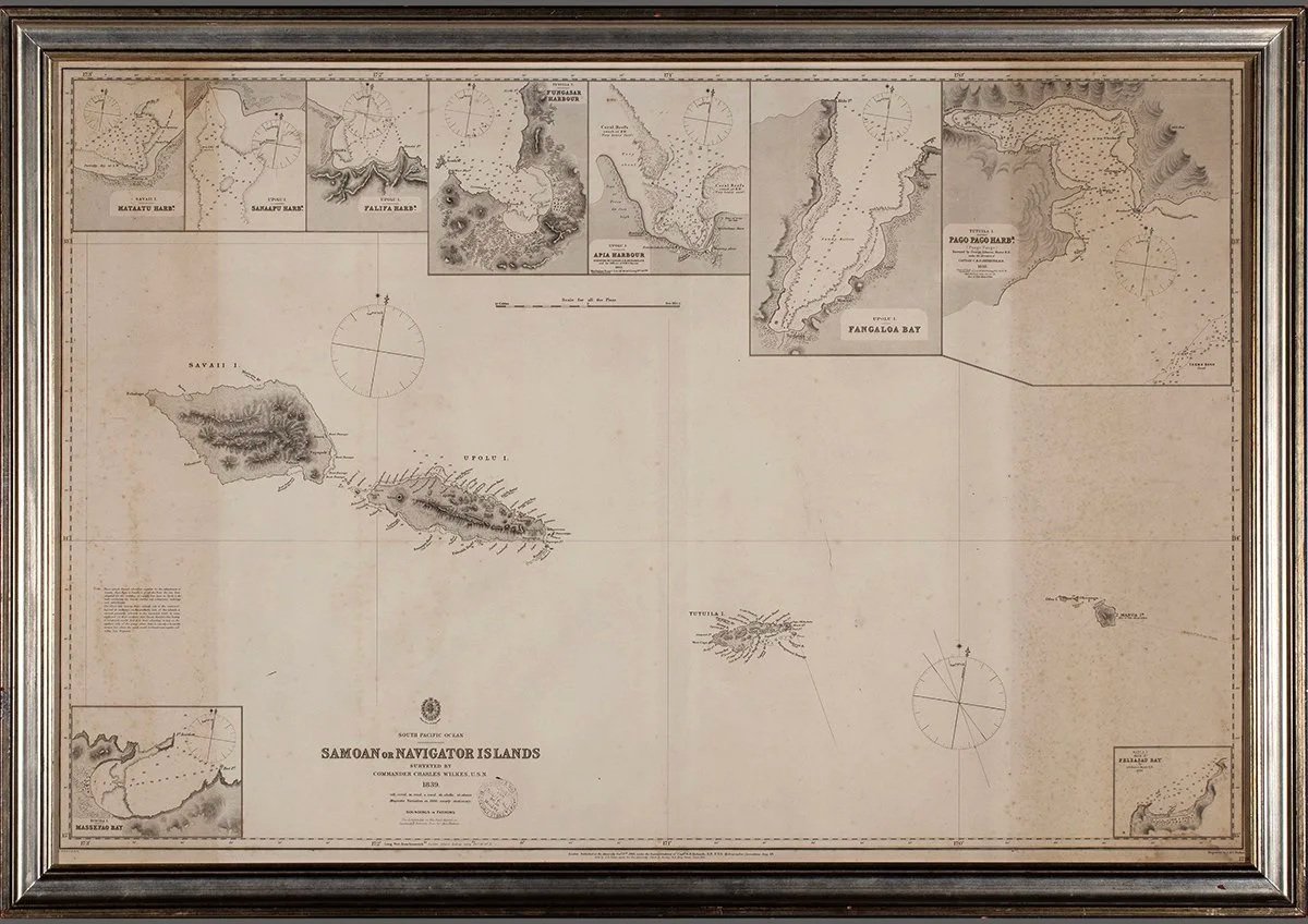 Image 2 of 3
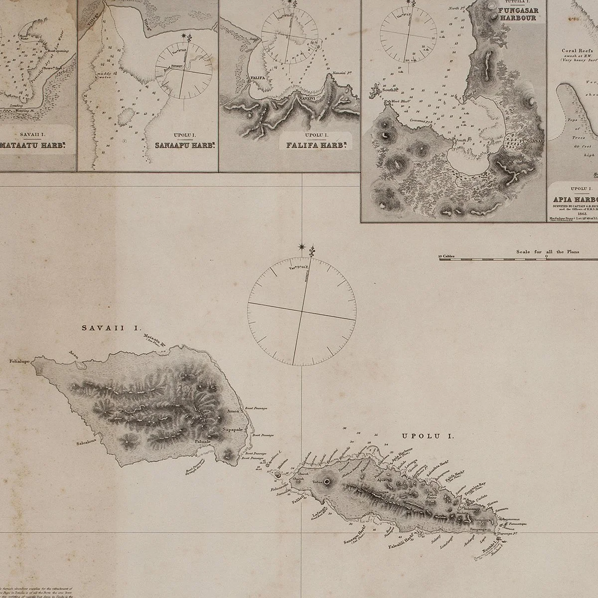 Image 3 of 3
British Admiralty, surveyed under Charles Wilkes, Commander USN
Published 1866, under the supervision of Capt. G. H. Richards, Hydrographer to the Admiralty, October 3, 1866; based on surveys conducted 1839
Engraving on paper, framed
Sheet: 29 1/2 x 42 in. (74.9 x 106.7 cm)
Provenance: Donald Stanley Marshall, Pacific scholar, Peabody Museum, Salem, MA
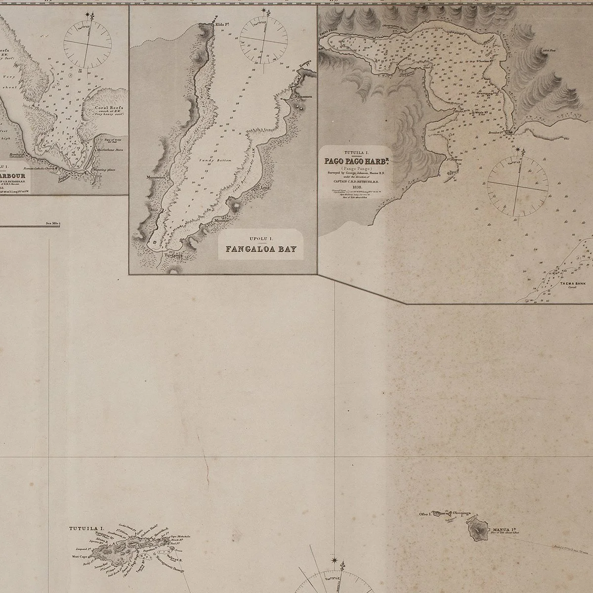
This is the Admiralty's large-format chart of the Samoan or Navigator Islands, published in 1866 and based on hydrographic surveys carried out during the United States Exploring Expedition under Charles Wilkes in 1839. The chart includes a main map of the island group with compass roses and soundings, along with inset harbor charts of Apia, Pago Pago, Pangaloa Bay, and several smaller anchorages. It represents the most detailed cartographic treatment of the Samoan archipelago produced to that point and remained a navigational reference for the region through the latter nineteenth century.
The engraving is cleanly executed with fine linework throughout, showing topographic hachuring of the island interiors and detailed coastal annotation. This example was held by Donald Stanley Marshall, a Pacific scholar associated with the Peabody Museum in Salem, Massachusetts, where it hung in his office. The frame is a period-appropriate silver-toned molding consistent with the map's institutional display history.
We ship free anywhere in the world, fully insured, packed by hand.
British Admiralty, surveyed under Charles Wilkes, Commander USN
Published 1866, under the supervision of Capt. G. H. Richards, Hydrographer to the Admiralty, October 3, 1866; based on surveys conducted 1839
Engraving on paper, framed
Sheet: 29 1/2 x 42 in. (74.9 x 106.7 cm)
Provenance: Donald Stanley Marshall, Pacific scholar, Peabody Museum, Salem, MA
This is the Admiralty's large-format chart of the Samoan or Navigator Islands, published in 1866 and based on hydrographic surveys carried out during the United States Exploring Expedition under Charles Wilkes in 1839. The chart includes a main map of the island group with compass roses and soundings, along with inset harbor charts of Apia, Pago Pago, Pangaloa Bay, and several smaller anchorages. It represents the most detailed cartographic treatment of the Samoan archipelago produced to that point and remained a navigational reference for the region through the latter nineteenth century.
The engraving is cleanly executed with fine linework throughout, showing topographic hachuring of the island interiors and detailed coastal annotation. This example was held by Donald Stanley Marshall, a Pacific scholar associated with the Peabody Museum in Salem, Massachusetts, where it hung in his office. The frame is a period-appropriate silver-toned molding consistent with the map's institutional display history.
We ship free anywhere in the world, fully insured, packed by hand.